14 November 2026
Comparing Drone Progress Monitoring with Manual Site Photo Reporting
Presented by @dronesitejournal
How Construction Teams Track Progress Today
On any construction site, keeping a clear record of what has been done and when is vital for project timelines, budgets, and stakeholder communication. For years, the standard method has been manual site photo reporting: a project manager or site supervisor walks the site with a camera, takes photos from various vantage points, and later organizes those images into a report. This approach has served the industry well, but it comes with limitations in consistency, coverage, and time efficiency.
Drone-based monitoring has emerged as a compelling alternative. By capturing aerial imagery on a regular schedule, construction teams can produce high-resolution visual records that show the entire site at once. The question is not which method is universally better, but rather which fits a given project's needs, budget, and workflow. Understanding the trade-offs helps teams decide when to rely on manual methods and when to adopt drone-based approaches.
Manual Site Photo Reporting: Strengths and Weaknesses
Manual photo reporting is straightforward. A person with a camera or smartphone walks the site, takes images of specific areas, and later compiles them into a folder or document. The process requires no special equipment beyond a standard camera, and the person taking photos can focus on particular details, such as a crack in a foundation or the placement of rebar. This targeted approach can be useful when only a few specific areas need documentation.
However, manual reporting has several drawbacks. Coverage is limited to what the photographer can see and physically reach. On a large site, it is easy to miss areas, especially if the terrain is rough or if access is restricted. Consistency between reporting periods is another challenge: the same location may be photographed from a slightly different angle each time, making it difficult to compare progress accurately. The process is also time-consuming, both in the field and during post-processing, and it relies heavily on the discipline of the person assigned to the task.
For very small sites or projects where only a few images are needed, manual reporting can still be cost-effective and sufficient. But for larger or more complex projects, the limitations become more apparent.
Drone Progress Monitoring: What It Offers
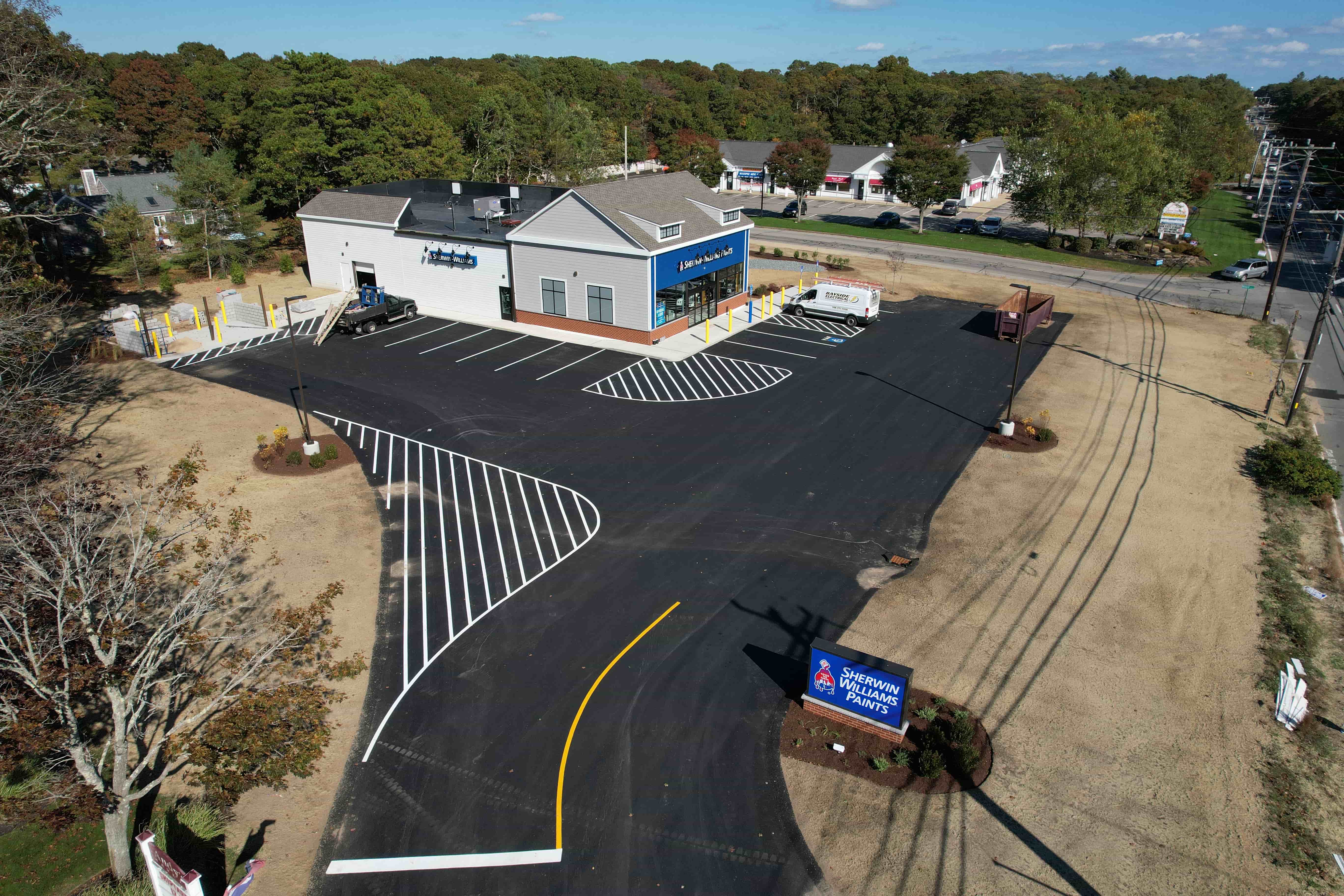
Drone-based monitoring changes the equation by providing a bird's-eye view of the entire site in a single flight. A drone can cover a large area in a short time, capturing overlapping images that can later be stitched into an orthomosaic or a 3D model. This gives project managers a complete picture of the site at a given flight date, making it easier to see overall progress and spot issues that might be invisible from the ground.
One of the key advantages is consistency. When a drone follows a pre-programmed flight path, it captures images from the same positions and angles every time. This repeatability allows for accurate change detection over time. For example, comparing orthomosaics from two consecutive weeks can reveal exactly where earth has been moved, where new foundations have been poured, or where utility lines have been laid. This level of detail is difficult to achieve with manual photography.
Another benefit is the ability to share data easily. Aerial imagery can be uploaded to a cloud-based platform where stakeholders can view, annotate, and compare images side by side. This reduces the need for site visits and allows remote teams to stay informed. The term drone progress tracking captures this systematic approach to monitoring construction sites over time, providing a reliable record that supports decision-making.
When Manual Reporting Still Makes Sense
Manual photo reporting is not obsolete. For very small projects, such as a single residential renovation or a small commercial build, the cost and complexity of deploying a drone may not be justified. In such cases, a few well-taken ground photos can suffice. Manual methods also excel when close-up detail is needed, for example, to document a specific weld, a crack, or a material defect. A drone camera, while capable of high resolution, may not capture the same level of detail from a distance.
Additionally, manual reporting works well in environments where drone flight is restricted, such as near airports, in dense urban areas with strict regulations, or indoors. In these situations, a person with a camera is the practical choice. The key is to recognize that manual and drone methods are not mutually exclusive; many projects use both, with drones providing the overall site context and manual photos filling in the close-up details.
When Drone Monitoring Adds Value
Drone-based monitoring becomes valuable when the site is large, the project timeline is long, or multiple stakeholders need regular updates. For infrastructure projects like highways, bridges, or pipelines, the ability to see the entire corridor in one image is a significant advantage. Similarly, for multi-building developments or projects with complex earthworks, drone progress tracking provides a level of oversight that manual methods cannot match.
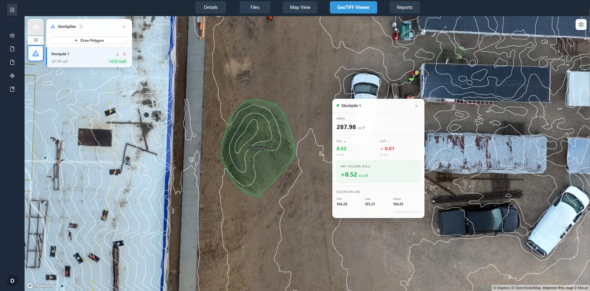
Another scenario where drones shine is in documenting progress for compliance or dispute resolution. A consistent, timestamped aerial record can serve as objective evidence of what was done and when. This can be crucial when contractors, owners, or regulators need to verify that work meets specifications. The orthomosaic and change detection outputs from a drone data platform like DataDelivery make it easy to overlay design plans onto actual site conditions, highlighting discrepancies early.
For teams already using digital tools for project management, integrating drone data into those workflows is becoming simpler. Many platforms now accept georeferenced imagery, allowing site annotations to be made directly on the map. This turns the aerial data into an actionable part of the project timeline rather than just a visual record.
Making the Choice: Factors to Consider
Deciding between manual and drone-based methods depends on several factors:
- Site size and complexity: Larger or more complex sites benefit from the comprehensive coverage a drone provides. Small, flat sites may be adequately served by manual photos.
- Frequency of reporting: If progress needs to be tracked weekly or even daily, a drone can automate much of the capture process, saving time. Manual reporting at that frequency becomes a significant burden.
- Budget: While drone hardware and software have initial costs, manual reporting also has hidden costs in labor and time. A cost-benefit analysis should consider the entire project duration.
- Regulatory environment: If flights are restricted, manual methods may be the only option. In other cases, obtaining a waiver or using a certified pilot can make drone monitoring feasible.
- Need for precision: For applications requiring measurements, volumetrics, or precise overlays, drone data processed through a platform like DataDelivery provides far greater accuracy than manual photos.
It is also worth noting that the two approaches can complement each other. A common workflow is to use drone flights for the overall site overview and supplement them with manual close-ups of specific areas. This hybrid approach gives teams the best of both worlds: the big picture and the fine detail.
Practical Steps for Getting Started
For teams new to drone monitoring, the first step is to define the project's documentation needs. How often should the site be captured? What level of detail is required? Who will use the data and for what purpose? Answering these questions helps determine whether a drone-based approach is warranted.
Next, consider the logistics. Will the drone be operated by an in-house pilot or a service provider? How will the data be processed and stored? Platforms like DataDelivery simplify the post-flight workflow by handling image stitching, organizing data by flight date, and providing tools for comparison and annotation. This removes much of the technical overhead and allows teams to focus on using the data rather than managing it.
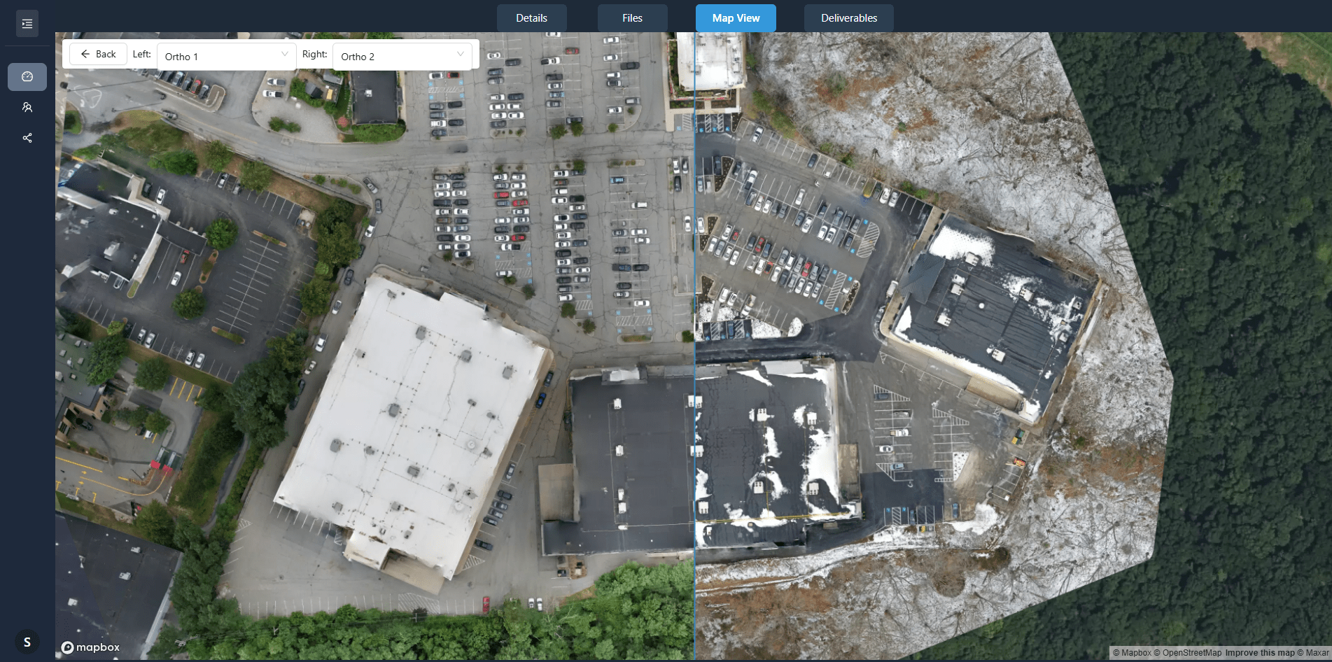
Finally, establish a baseline. The first flight should capture the site in its initial state. Subsequent flights at regular intervals build a timeline that shows progress and changes. Over time, this archive becomes a valuable resource for project management, quality control, and client communication.
Drone progress tracking is not a replacement for human judgment, but it is a powerful tool for seeing what is happening on site without being there. When combined with the right data platform, it turns raw images into actionable insights that support better decisions throughout the project lifecycle.